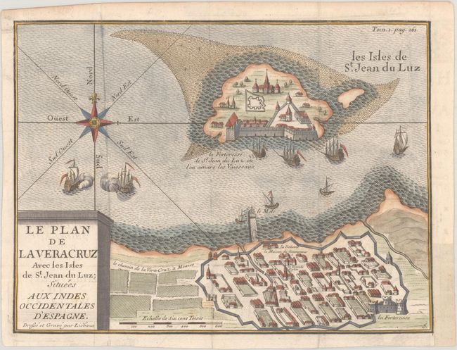
Subject: Veracruz, Mexico
Period: 1744 (circa)
Publication: Histoire des Aventuriers Flibustiers...
Color: Hand Color
Size:
8.3 x 6.3 inches
21.1 x 16 cm
This rare decorative map of Veracruz appeared in the French edition of Alexandre Olivier Exquemelin's History of the Bucaniers of America, a fascinating work describing the voyages and adventures of numerous buccaneers who sailed throughout the New World. Exquemelin's work was first published in Dutch in 1678 and was very popular, appearing in nearly every European language within ten years of its publication, and continued to be issued for nearly 100 years. Veracruz was the first port established in New Spain by Hernan Cortes in 1519, and was a scene of many battles during the ensuing years. The port was a frequent target of pirates, leading to the construction of the fortress at San Juan de Ulua (here called St. Jean du Luz). The map shows a bird's-eye plan view of the city and the fortress on the adjacent island. Several ships fill the waters between the coast and island, with a battle taking place beneath the ornate compass rose. Drawn and engraved by Jean Baptiste Liebaux, best known for his engraving work for Nicolas de Fer.
References:
Condition: A
A crisp impression issued folding, now flat, with a few minor spots and a binding trim in the bottom right blank margin that has been replaced with old paper.