Subject: Pennsylvania
Period: 1867 (dated)
Publication:
Color: Printed Color
Size:
41.9 x 29.9 inches
106.4 x 75.9 cm
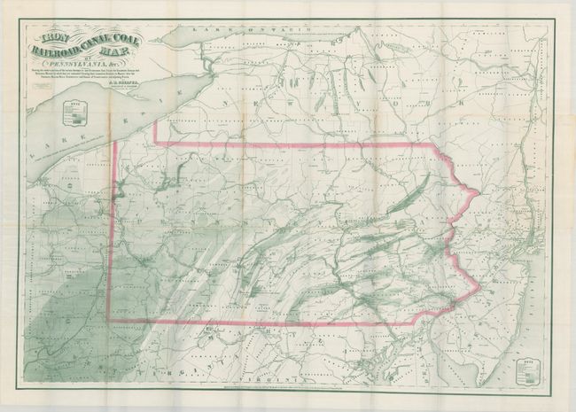
This detailed map of the Pennsylvania coal fields was compiled by geologist and engineer P.W. Sheafer. It shows "the relative position of various Anthracite and Bituminous Coals Fields the Railroads, Canals and Navigable Waters by which they are connected forming their respective Avenues to Market." Through both shading and pattern, the map identifies coal, limestone, and oil as well as mills, furnaces, steel works, mines and railroads. The map extends beyond Pennsylvania to neighboring states, including coal deposits in Ohio and West Virginia. While Pennsylvania coal was mined as early as 1813, it was not widely used due to the challenges of transporting it to eastern cities. With the evolution of the railroad network including the Philadelphia & Erie, Lehigh Valley, and Schuylkill & Susquehanna railroads, transporting coal became significantly more cost effective and coal production accelerated. Published by Jacob Haehnlen in Philadelphia.
References:
Condition: B+
Issued folding on a clean bright sheet with light toning and a few tiny separations along the folds. A short edge tear is confined to the left blank margin.