Subject: World
Period: 1780 (circa)
Publication:
Color: Hand Color
Size:
17.4 x 13.4 inches
44.2 x 34 cm
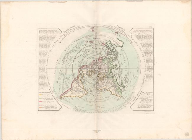
This uncommon and unusual thematic map is presented on a North Polar projection and depicts the tracks of several important explorers including Tasman, Halley, and Magellan. The color-coding identifies which landmasses drain into the various bodies of water around the world. Inland detail is confined to rivers and major mountain ranges depicted with strong hachuring. In North America there is a large Sea of the West and a nearly complete Northwest Passage. Australia is still shown with a conjectural coastline, making it considerably too wide. The continent connects to both New Guinea and Terre du St. Esprit (the Land of the Holy Ghost), discovered by Queiroz. This is the second state, published by Dezauche. Engraved by Desbruslins.
References: McGuirk #60; cf. Phillips (Maps) p. 1091; Potter pp.178-9 (illus).
Condition: B+
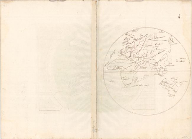
A nice impression in full contemporary color on a bright sheet with a "T[heart]Richard Auvergne] watermark. There are some small wormholes and minor toning along the centerfold in map image, and a 1" abrasion in an unengraved area at left. Light dampstains and a pair of wormtracks are confined to the blank margins. On verso is an old manuscript ink drawing of the eastern hemisphere.