Subject: San Diego, California
Period: 1926 (dated)
Publication:
Color: Printed Color
Size:
27.1 x 21 inches
68.8 x 53.3 cm
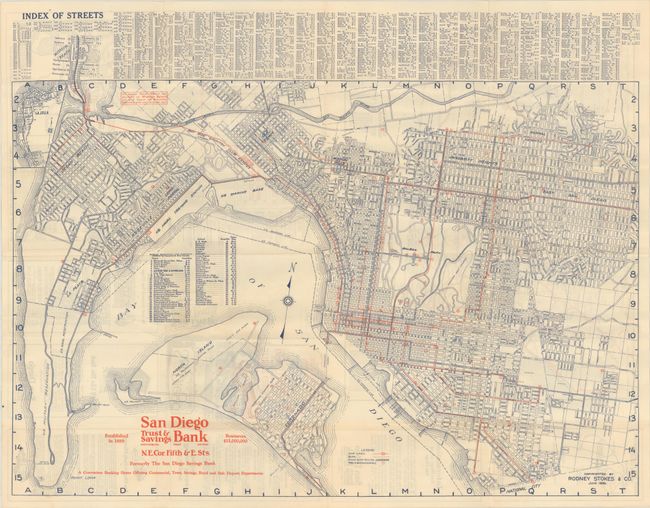
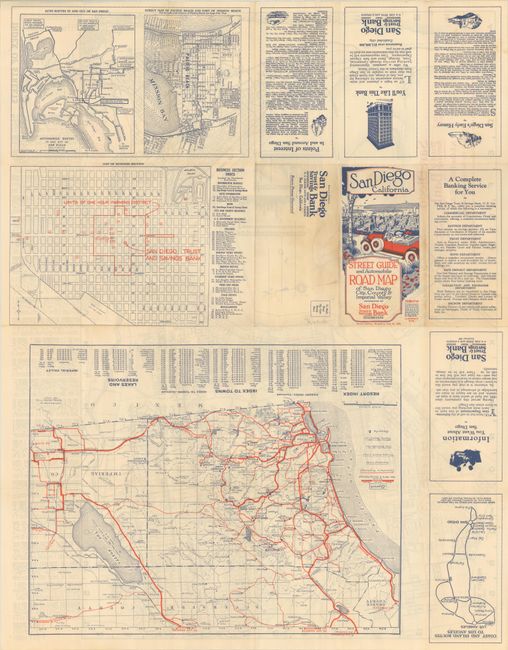
This detailed map of San Diego was created by Rodney Stokes & Co. for the San Diego Trust & Savings Bank. Printed in blue ink, the map extends from La Jolla and Point Loma east to Coronado, Balboa Park, and Talmadge Park. A legend at bottom locates car lines, bus lines, and public buildings/schools in red overprinting. The public buildings are keyed to a table at center, and a detailed street index is located above the map. The verso contains a large map of Southern California, a smaller map of the San Diego Business Section, bank advertisements, and more. Second edition. Self-folding (3.8 x 6.9”) with a view of the city on the front wrapper. We found only one institutional example (Stanford) on OCLC.
Local mapmaker Rodney Stokes Co. was a major publisher of San Diego maps for four decades.
References:
Condition: A
Issued folding on a clean bright sheet with some light show-through from verso.