Catalog Archive
Auction 196, Lot 199

"Chart of the Sacramento River from Suisun City to the American River California", Ringgold, Cadwalader

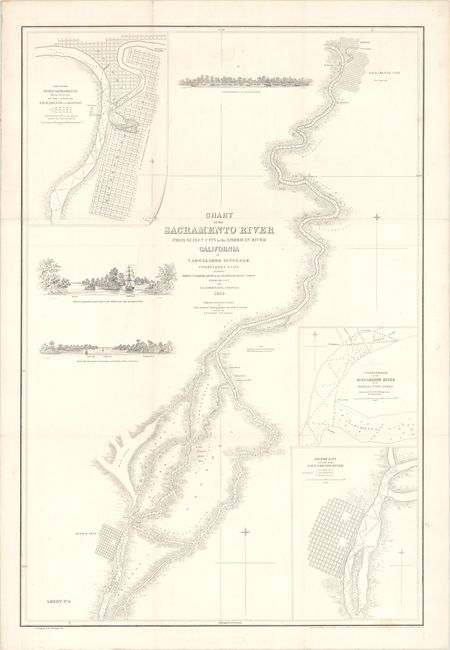
Subject: Northern California

Period: 1851 (dated)

Publication:

Color: Black & White

Size:
20.3 x 30.1 inches
51.6 x 76.5 cm
Download High Resolution Image
(or just click on image to launch the Zoom viewer)

This uncommon chart extends from below Suisun City north along the Sacramento River up to the city of Sacramento and the confluence with the American River. The river is filled with copious soundings and small islands while vegetation is symbolically depicted along its banks. The street-grid pattern of both Suisun City and Sacramento are drawn, and Sutter's Fort is located east of Sacramento. Completing the chart are three insets and approach views at various points on the river.

Naval Commander Ringgold was charged with producing the first detailed survey of the region - a task that became especially important with the recent discovery of gold. Ringgold received financial support from local citizens to expand the scope of his charge and reduce the risks of navigation. His groundbreaking work included especially detailed surveys along the rivers that also showed new settlements. Ringgold sought publication of his work by the federal government, but during a period of intense rivalry between the Coast Survey and Navy, Senator Jefferson Davis questioned the accuracy of Ringgold’s survey and his request was denied. As a result, Ringgold’s charts and report were privately printed. For an excellent summary of the importance of Ringgold’s work during the Gold Rush, click here.

References:

Condition: B+

Issued folding on a sturdy bright sheet with two printer's creases adjacent to the title and a minor stain below the upper neatline. There are short splits at two fold junctions and a 3" fold separation at top that have all been repaired on verso with archival tape.

Estimate: $300 - $375

Unsold

Closed on 2/7/2024

Archived