Subject: Southwestern United States
Period: 1875 (dated)
Publication: U.S. Geographical Surveys West of the 100th Meridian
Color: Black & White
Size:
19.1 x 14.9 inches
48.5 x 37.8 cm
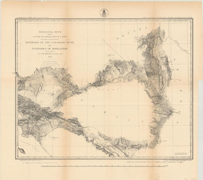
This map is an early effort at determining the practicality of getting water from the Colorado River to the Los Angles basin. Under the direction of Brig. Gen. A.A. Humphreys, 1st Lieut. Eric Bergland's route is here detailed as he explored a portion of the lower Colorado. The party's route appears to lead from Los Angeles east and north across southern California to the river, north to Store's Ferry, then south to Ehernberg. The inward route took them from Ehernberg west across the Coachella Valley, past San Bernardino and back to their starting point. Along the route is much detail with many places and features named. The coast of Southern California is well mapped up to Santa Monica and the map shows some early towns including Anaheim, San Pedro, Wilmington, and El Monte.
The reality of bringing water from the Colorado River was finally realized more than 65 years later with the completion of the Colorado River Aqueduct in 1941.
References:
Condition: B+
Issued folding and now flattened and backed with tissue to reinforce and repair several small fold separations. There is light toning along the folds.