Subject: Southwestern United States
Period: 1871 (dated)
Publication:
Color: Hand Color
Size:
33.1 x 30.3 inches
84.1 x 77 cm
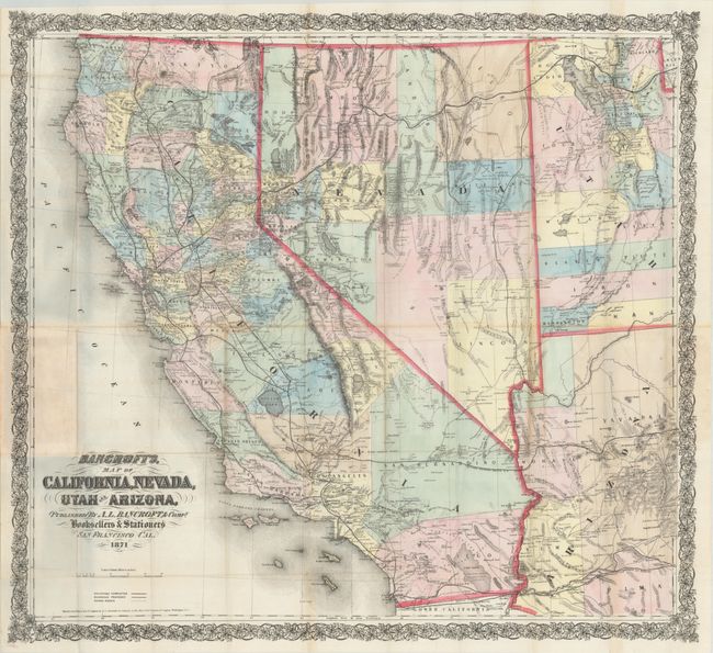
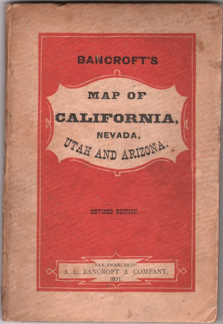
This large pocket map was first published in 1864 by Bancroft, who Wheat describes as the "greatest map publisher of the Pacific Coast." It covers all of California and Nevada along with the western parts of Utah and Arizona extending to Salt Lake City and Prescott. There is remarkable detail, particularly in the mining regions, with a large number of camps and towns named. The map also depicts railroads, current and proposed, wagon roads, hundreds of towns, springs, forts, and more. Embellished by fancy, Victorian-style titling and a decorative wide border. Printed on fine banknote-style paper and folds into original printed boards (4.3 x 6.4”). The inside front cover features a list of maps and other publications available from Bancroft with pricing (this map originally cost only $1.50). A scarce and attractive map that is in remarkable condition.
References: cf. Wheat (TMW) #1093; cf. Wheat (Gold) #321.
Condition: A
Issued folding on a clean bright sheet with one tiny split at a fold junction and a few minor creases. Covers have light soiling and minor wear. An overall excellent example.