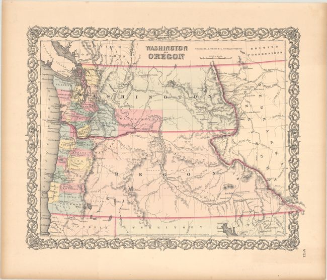
Subject: Washington & Oregon
Period: 1853 (dated)
Publication:
Color: Hand Color
Size:
16.1 x 12.9 inches
40.9 x 32.8 cm
A great map of the Pacific Northwest showing both territories extending to the Continental Divide and incorporating the region that would become Idaho. Of specific interest is the notation of wagon trails and the proposed route for the transcontinental railway as explored by Governor Stevens. A few organized counties are confined to a narrow band along the coast and Wascopen, Skamania, and Walla Walla are the only counties east of the Cascade Range. Very little information is displayed in the area of today's Idaho except for Fort Hall, the nearby Cantonment Loring, and an early reference to Soda Springs as "Beer or Soda Springs." The map locates numerous forts including Boise, Benton, Owen, Colville, and Hall. The important landmarks of Three Buttes and the Three Tetons are noted in the lower portion of Washington Territory. Dated 1853 but published circa 1854.
References:
Condition: A
Contemporary color with light marginal toning.