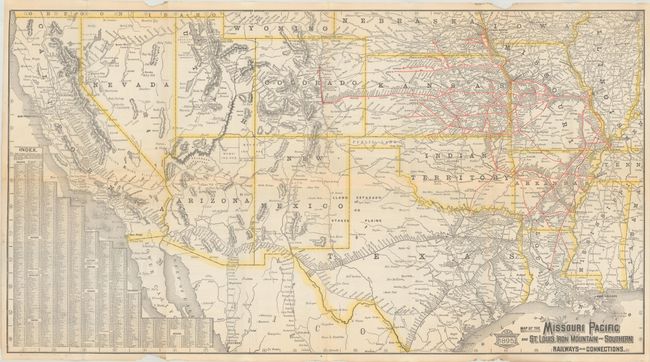
Subject: Western United States
Period: 1895 (dated)
Publication:
Color: Printed Color
Size:
30.6 x 16.6 inches
77.7 x 42.2 cm
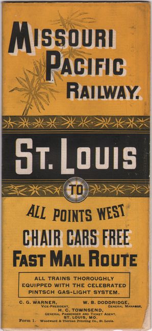
This is a folding map and timetable for the Missouri Pacific Railway (1872-1997), which consolidated many smaller railroads to build their massive network. The company's routes are shown in red overprinting and originate in St. Louis and travel westward though Missouri, Kansas and Colorado, while also stretching south into Indian Territory and Arkansas. Other railroads are shown in black line throughout Texas and the west, extending to the Pacific Ocean. There is an index at lower left and an extensive timetable on verso. Self-folding (4.0 x 8.7") into colored wrappers.
References:
Condition: B+
Issued folding with a couple of short splits at the fold junctions and very faint dampstaining along the horizontal fold at left. There are a pair of chips confined to the top and bottom blank margins.