Subject: Southern United States, Georgia
Period: 1795 (circa)
Publication:
Color: Black & White
Size:
7.5 x 6.3 inches
19.1 x 16 cm
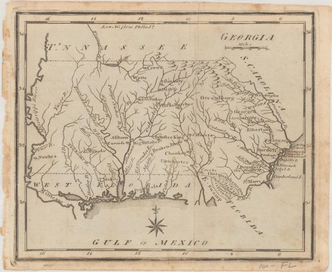
This lovely, small map of Georgia is the first state of this early American produced map. It shows Georgia's boundary extending from the Atlantic Ocean westward to the Mississippi River, with New Orleans, Mobile and the coast shown in West Florida. The Okefenokee Swamp is named the Ouaquaphenogaw Swamp. This map was first published in Joseph Scott's important The United States Gazetteer in 1795, and then reprinted unchanged for The New and Universal Gazetteer.
References: Wheat & Brun #612; McCorkle (18th C. Geog. Books) #378-4 & #379-4.
Condition: B+
Issued folding with minor offsetting and scattered foxing.