Subject: Southern United States
Period: 1793 (circa)
Publication: The History of the Rise... of the United States... Vol. I
Color: Black & White
Size:
14.6 x 11.8 inches
37.1 x 30 cm
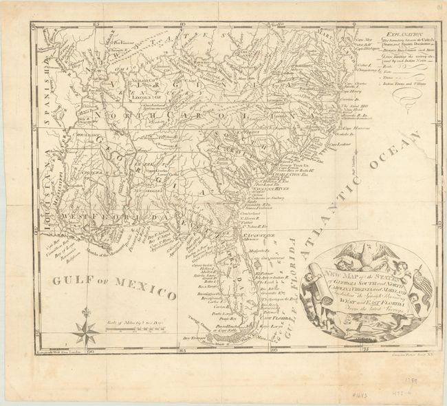
An attractive and delicately engraved map showing the southern United States with Virginia, North Carolina, and Georgia all extending to the Mississippi River. Florida is under Spanish control and divided between East & West, and beyond the Mississippi River is Spanish Louisiana. The region above the Ohio River is reserved for "New States." This is an updated version of Joseph Purcell's A Map of the States of Virginia, North Carolina, South Carolina and Georgia... with the State of Franklin and the Seven Ranges removed. Adorned by a decorative cartouche with scroll title being held aloft by putti. This map appeared in the second American edition of Gordon's renowned history of the American War. An early American-produced map engraved by C. Tiebout in New York City.
References: Wheat & Brun #495.
Condition: B
A nice impression, issued folding on a bright sheet with light soiling and a few tiny holes at fold intersections. There are archival repairs to several fold separations along the edges of the sheet and to a 2" tear at right.