Subject: Alabama & Georgia
Period: 1823 (dated)
Publication: American Atlas
Color: Hand Color
Size:
28.3 x 21.6 inches
71.9 x 54.9 cm
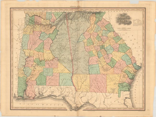
This large, attractive map was published in Tanner's first edition American Atlas, which is considered one of the finest American atlases ever published. Delineated by county, the map is filled with detail of cities and towns, wagon roads, forts, battle grounds, places of worship, public houses, drainage and topography. The map also shows distances from various locations to the state capitals. A large region along the boundary between the two states is dedicated to the Cherokee and Creek Indians. County development is current to 1822 with the addition of Bibb, Crawford, De Kalb and Pike Counties in Georgia and prior to the creation of Walker County in Alabama. Two distance scales show American and Geographical Miles.
Henry Schenck Tanner was one of the most productive and successful cartographic publishers of the early nineteenth century, a period known as the golden age of American cartography. The large, beautifully engraved maps from this atlas were considered among the "most splendid works of the kind ever executed in this country," as reported in the United States Gazette (Philadelphia) in 1823.
References: Phillips (Atlases) #4462-9; Ristow pp. 191-206.
Condition: B+
A sharp impression with full contemporary color, light toning along the centerfold, minor offsetting, and archivally repaired centerfold separations at top and bottom. There are chips and tears along the edges of the sheet.