Subject: New England & Mid-Atlantic United States
Period: 1799 (circa)
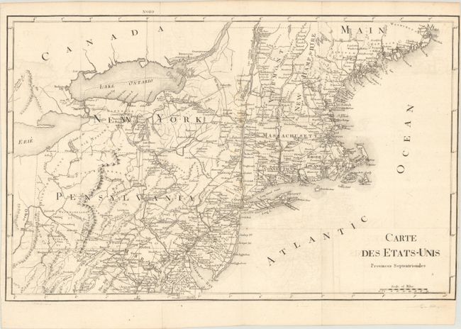
Publication: Voyage dans les Etats-Unis d'Amerique...
Color: Black & White
Size:
20.1 x 12.7 inches
51.1 x 32.3 cm
Uncommon French edition of this interesting map that covers all of the Northeast and Mid-Atlantic, extending south to below Alexandria and west to beyond Wheeling on the Ohio River. The entire map is in English with only the title in French. Early county development in Pennsylvania is current to 1794, prior to the organization of Greene and Lycoming counties. The Lands of the Six Nations appear in western New York beside Lake Erie. There is very good detail of roads and settlements throughout the region. The English edition, titled Map of the Northern Provinces of the United States, was engraved by John C. Russell and published by R. Phillips, but this edition carries no such attribution.
References: Howes #L106; cf. McCorkle #799.7; Sabin #39056.
Condition: B+
A crisp impression issued folding on paper with a bunch of grapes watermark. There is a light foxing along the fold at center and minor offsetting. The right margin has been trimmed close to neatline by the binder.