Catalog Archive
Auction 196, Lot 148

"Carte de la Partie Nord, des Etats Unis, de l'Amerique Septentrionale", Bonne, Rigobert

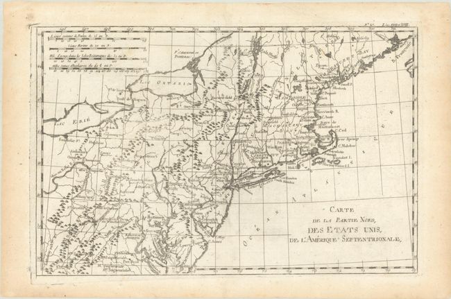
Subject: New England & Mid-Atlantic United States

Period: 1783 (circa)

Publication: Raynal's Histoire Philosophique et Politique…

Color: Black & White

Size:
12.7 x 8.3 inches
32.3 x 21.1 cm
Download High Resolution Image
(or just click on image to launch the Zoom viewer)

This very early map presents the northern part of the newly-formed United States. It covers the region from northern Virginia to Maine (Machasuzet Bay), and westward to include Lake Erie. The map has good topographical detail, and it also includes numerous settlements, forts, and Indian villages. It locates Baltimore, Annapolis, Alexandria, New York, Boston, Ft. Halifax, and much more. There are four distance scales at upper left.

References: McCorkle #782.1C; Sellers & van Ee #744.

Condition: A

On a clean sheet of watermarked paper with a short repaired edge tear confined to the top blank margin. Light toning is also confined to the blank margins.

Estimate: $100 - $130

Sold for: $75

Closed on 2/7/2024

Archived