Subject: Colonial New England & Mid-Atlantic United States
Period: 1777 (published)
Publication: The English Magazine
Color: Black & White
Size:
10 x 7.5 inches
25.4 x 19.1 cm
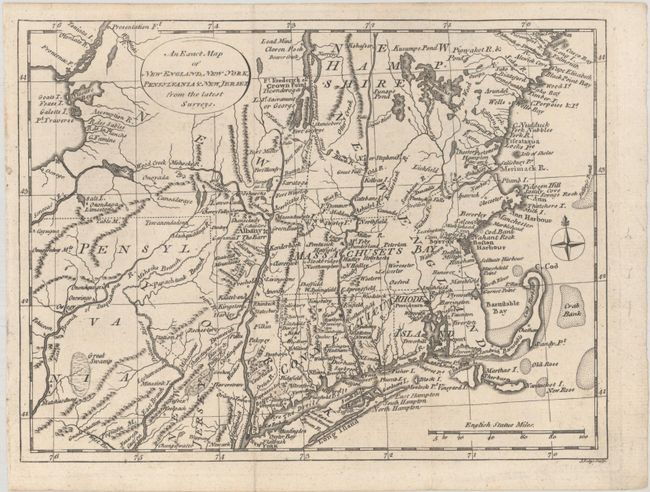
A scarce Revolutionary War-period map focused on the Northeast from Pennsylvania to New Hampshire, centered on the Hudson and Connecticut rivers. New Hampshire extends to Lake Champlain and Pennsylvania's northern border is about a degree further north than its present boundary. A number of important forts are identified along the Hudson River and Lake Champlain, including Edward, Miller, George and Frederick. Indian settlements, identified by small triangles, are located primarily to the west of the Hudson River. The map was originally bound into the December 1777 issue of English Magazine. This map was also used in William Russell’s The History of America in 1778. This is only the second time we have encountered this map.
References:
Condition: A
Issued folding, now flat, on a clean sheet.