Catalog Archive
Auction 196, Lot 135

"New Map of the American Overland Route Showing Its Connections, and Land Grants of 30,000,000 Acres", Rand McNally & Co.

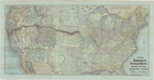
Subject: United States, Railroads

Period: 1878 (dated)

Publication: The Sportman’s Gazetteer and General Guide

Color: Printed Color

Size:
35.8 x 17.5 inches
90.9 x 44.5 cm
Download High Resolution Image
(or just click on image to launch the Zoom viewer)

This detailed map presents the nation's railroad network extending to the Pacific Ocean. The main line of the Union Pacific Railroad is prominently depicted in black overprinting between Omaha and San Francisco with stations noted along the route. Additional spoke lines link Provo, Salt Lake City, and central California to the main line. The map uses shading along the main line to show the extensive land grants given to the railroad to fund the project, which were in turn sold to the general public. A large section of the line in Wyoming is noted to have "extensive deposits of coal and iron," no doubt to entice purchase of these lands. This is a somewhat misleading representation of land grants, however, as most grants were for alternate sections of land along the route. Additionally, the railroads were not able to sell all of these grants and many reverted back to the federal government. Land grants were a topic of great debate in the coming years and even used in an 1884 campaign poster by Democrats claiming a giveaway of public lands to special interests.

References:

Condition: B+

Issued folding on bluish paper with numerous short splits around the fold junctions and a 1.75" edge tear at right that have all been archivally repaired on verso.

Estimate: $240 - $300

Sold for: $250

Closed on 2/7/2024

Archived