Subject: United States
Period: 1861 (circa)
Publication:
Color: Hand Color
Size:
12 x 9.9 inches
30.5 x 25.1 cm
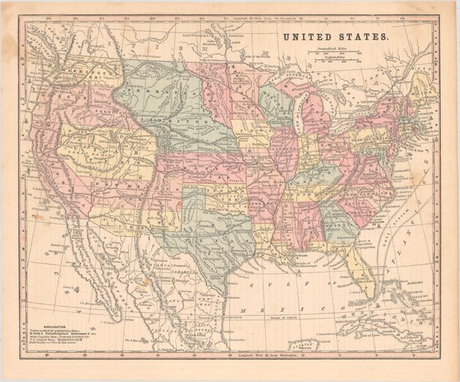
This map was issued on the eve of the Civil War and depicts the ephemeral Jefferson Territory along the eastern slope of the Rocky Mountains. This extralegal and unrecognized territory of the United States existed from October 24, 1859 until the creation of the Colorado Territory on February 28, 1861. Naming a northern territory after a southern President as the Civil War approached apparently did not sit well with Congress.
In addition to Jefferson, the map shows an evolving West with Arizona occupying the southern part of New Mexico Territory indicating the Confederate Territory of Arizona. The map also depicts a large Nebraska Territory, a narrow Dakotah Territory, and an unnamed territory to the east of Oregon that became part of Idaho.
References:
Condition: B+
Light staining.