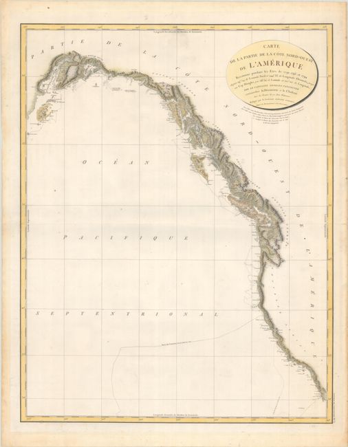
Subject: Western North America
Period: 1799 (circa)
Publication: Vancouver's Voyages (French Edition)
Color: Hand Color
Size:
23.3 x 29.6 inches
59.2 x 75.2 cm
This remarkably detailed chart covers the entire scope of Vancouver's expeditions of 1792-94. These expeditions finally closed the door on the idea of a Northwest Passage and at the same time opened the region to commerce and the fur trade. His charts of the lower Columbia River were used by Lewis and Clark on their monumental explorations. The chart includes the entire west coast from below San Diego north to Cook Inlet and Kodiak Island in Alaska. The finely engraved chart shows surprisingly good detail along the coast as it locates Port St. Francisco,, Monterey Bay, C. Mendocino, C. Fairweather, and more. Good detail up the Columbia River to Pte. Vancouver. Dotted lines delineate the tracks of Vancouver's ships along the coast. Drawn by Lieutenant Edward Roberts. A historical and desirable chart that is seldom offered in this larger edition.
References: Falk #1799-3.
Condition: A
A crisp impression on watermarked paper with a few faint spots in the image. There is minor toning in the blank margins and non-tacky old tape residue along the sheet edges on verso from a previous framing.