Subject: North America
Period: 1825 (dated)
Publication:
Color: Hand Color
Size:
12.1 x 16.1 inches
30.7 x 40.9 cm
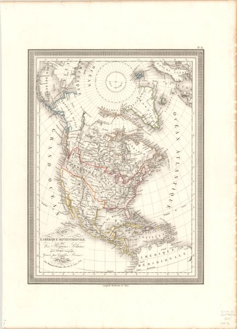
An attractive French map of North America depicting the river systems, topography, and early settlements. The Provinces Confederee (states) extend as far as Michigan and Missouri with a huge Missouri Territory to the west. In the Pacific Northwest, U.S. claims extend well into present-day British Columbia reflecting U.S. interests in the region. Alaska is Amerique Russe and borders Nouveau Cornouailles (New Cornwall). Texas is unnamed and part of Mexico with only a few settlements noted including San Antonio, Matagorda, and San Saba. California and the Southwest are also under Mexican control with a few spurious rivers crossing the Great Basin into the Pacific Ocean. In the polar region, the most recent discoveries are shown including those of Franklin, Hearn and Mackenzie. Surrounded by a bold keyboard-style border.
References:
Condition: A
A sharp impression with contemporary outline color on thick paper with toning along sheet edges.