Subject: Colonial North America
Period: 1780-1819 (circa)
Publication:
Color: Black & White
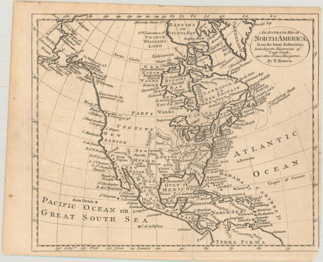
A. An Accurate Map of North America, from the Latest Authorities; Including the Discoveries of Capt. Cook, and Other Circum-Navigators, by Thomas Bowen, circa 1780 (9.4 x 7.8"). This small map of the continent shows the English colonies to the east of the Appalachian Mountains with a large Louisiana and New Mexico to their west. Much of the interior is labelled "Parts Unknown" with detail along the Pacific Coast including the place names New Albion, Cape Mendocino, and Prince William Sound. The coastline extends up to Alaska, which is beginning to take shape. Condition: Issued folding on a lightly toned sheet.
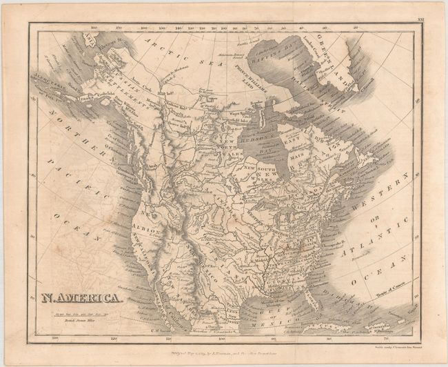
B. N. America, by Joseph Mawman, dated 1819 (9.6 x 7.8"). This map shows the United States extending to the Mississippi River with a large Western Territory taking up the Upper Midwest. Louisiana dominates much of the land between the Mississippi River and the Rocky Mountains, with New Mexico and New Albion to its west. Cities are noted along the eastern seaboard while river systems and Indian tribes fill the west. Alaska is Russian Settlements. Condition: Issued folding with light offsetting and minor foxing.
References:
Condition: B+
See description above.