Subject: Western Hemisphere - America
Period: 1769 (dated)
Publication:
Color: Hand Color
Size:
25.8 x 18.6 inches
65.5 x 47.2 cm
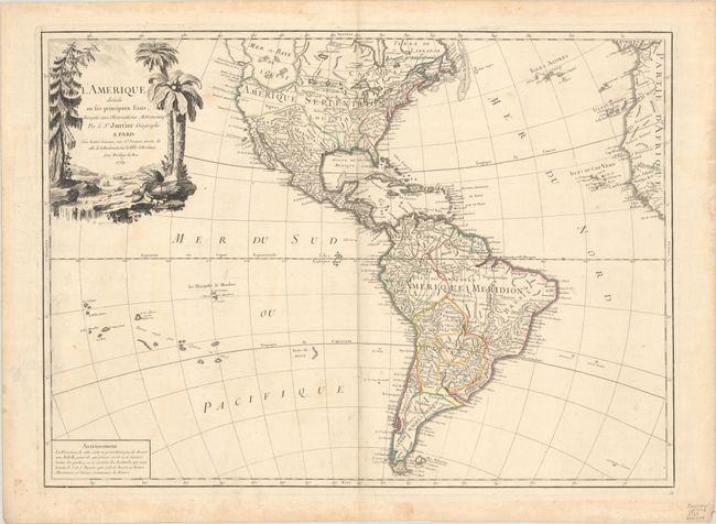
The most striking feature of this large, handsome map of North and South America is the huge Sea of the West. It is so massive that the northern portion of this mythical sea is not shown. Two entrances from the Pacific are noted: by Juan De Fuca in 1592 and by Martin d'Aguilar in 1603. It is connected by a series of rivers and lakes to Hudson Bay in the north and nearly connects to the Mississippi River in the south, thus presenting one of the most elaborate Northwest Passages of maps from this period. The balance of the map includes a myriad of information on cities, political boundaries, and river systems. The large decorative title cartouche shows unusual beaver dams in a stream with a pine tree on one bank and palm trees and a native's headdress and quiver on the other. Engraved by P.P. Choffard.
References: McGuirk #88.
Condition: B+
A nice impression with contemporary outline color on a lightly toned sheet with a large watermark of a Maltese cross encircled in rosary beads. There is some extraneous creasing and light soiling that is mostly confined to the edges of the sheet.