Subject: Central China
Period: 1655 (circa)
Publication: Novus Atlas Sinensis
Color: Hand Color
Size:
19.1 x 15.8 inches
48.5 x 40.1 cm
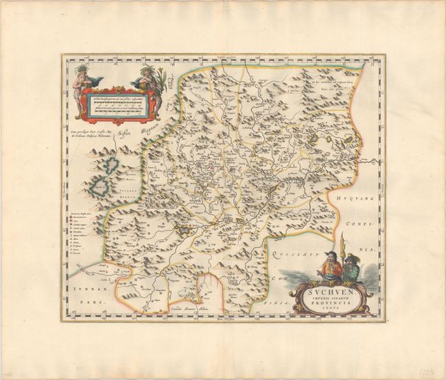
The second landmark in the European mapping of China was the appearance of the Novus Atlas Sinensis in 1655. It was compiled by Father Martino Martini, an Italian Jesuit and produced by the most prominent Dutch cartographer of the time, Johannes Blaeu. Father Martini compiled the work based on Chinese sources between 1643 and 1650, and it greatly advanced European knowledge of the region including the astronomical positions of many cities and topographical features. It remained the standard geographical work on that country until the publication in 1737 of D'Anville's Atlas de la Chine. This map of the Suchen province is decorated with two particularly graphic cartouches. The scales are flanked by mythical woodwose who represent the mighty Yangtze River, and a warlord and his guard stand behind the title cartouche.
References: Van der Krogt (Vol. II) #8426:2.
Condition: A+
A sharp impression with full contemporary color on a bright sheet with wide margins and a large watermark of the god Atlas. Minor foxing in the blank margins.