Catalog Archive
Auction 195, Lot 706
"China a New Description", Morden, Robert
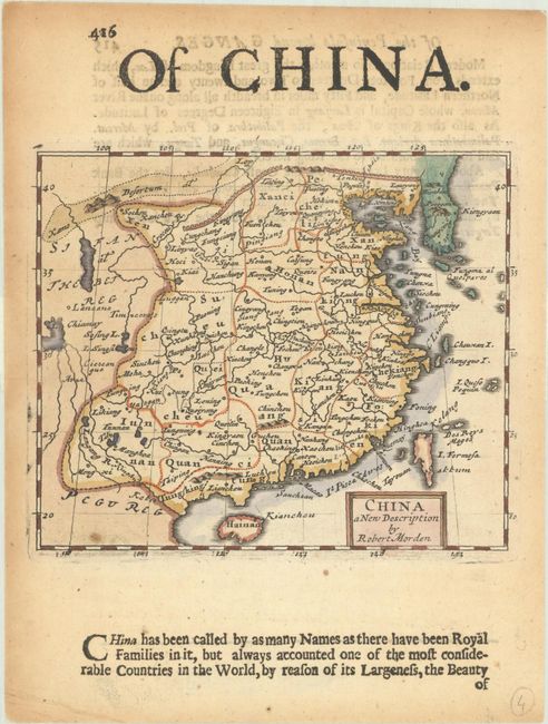
Subject: China
Period: 1680 (circa)
Publication: Geography Rectified...
Color: Hand Color
Size:
5.1 x 4.3 inches
13 x 10.9 cm
Download High Resolution Image
(or just click on image to launch the Zoom viewer)
(or just click on image to launch the Zoom viewer)