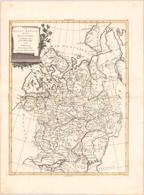
Subject: Russia in Europe
Period: 1781 (dated)
Publication: Atlante Novissimo
Color: Hand Color
Size:
12.5 x 16.1 inches
31.8 x 40.9 cm
This detailed map illustrates the western portion of the Russian Empire, extending between the Baltic Sea, to the Black Sea, to the Barents Sea. Political boundaries, towns, rivers and mountains are well depicted, and a dotted line connects Moscow with St. Petersburg.
Antonio Zatta was one of the leading Italian cartographers and publishers of the time, and his Atlante Novissimo was one of the most beautifully produced 18th century atlases. He drew on the work of contemporary cartographers including Robert de Vaugondy and Bellin, and developed his own distinctive elegant style.
References: Shirley (BL Atlases) T.ZAT-1a Vol. 2 #30.
Condition: A
Contemporary color on a bright sheet with very minor printer's ink residue and a hint of toning along the centerfold.