Subject: Southern Germany
Period: 1570 (published)
Publication: Theatrum Orbis Terrarum
Color: Hand Color
Size:
19.3 x 12.2 inches
49 x 31 cm
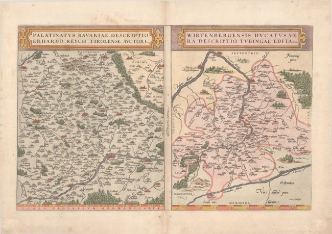
Two attractive maps on a folio sheet, each with their own strapwork cartouches, beautifully engraved by Frans Hogenberg. Both maps have charming pictorial depictions of cities and topography. Ortelius' map of Bayern (Bavariae) is based on the map by Erhart Reich. It is roughly centered on Amberg and extends to Nurnberg and Regensberg. The map of the Wurtemberg region (Wirtebergensis) is based on an anonymous map published in Tubingen in 1558. It is centered on Stuttgart and details the area between the Rhine and Danube rivers. Each map measures 9.5 x 12". Latin text on verso, published in the first edition of the Theatrum..
References: Van den Broecke #111.
Condition: A
A nice example with the crossed arrows watermark commonly found on Ortelius maps, a hint of toning along the centerfold, marginal soiling, and a professionally repaired centerfold separation at bottom.