Subject: Eastern Spain
Period: 1700 (circa)
Publication:
Color: Hand Color
Size:
18.9 x 14.6 inches
48 x 37.1 cm
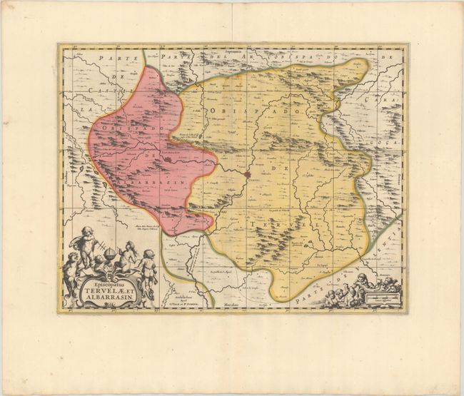
Beautifully decorated map of the southern portion of the Aragon region, based on the cartography of the Portuguese mapmaker Juan Bautista Labana (1555-1624). The map is centered approximately on Teruel and shows the mountainous topography in the region. The map is adorned with two cartouches featuring putti and cherubs. Petrus Schenk acquired the plate from Jansson's heirs and reissued the map with the imprint of his publishing partnership and with the addition of lines of latitude and longitude. Blank verso.
References: cf. Van der Krogt (Vol. I) #6240:1.
Condition: A
A sharp impression with full contemporary color on a bright sheet with wide margins and an archivally repaired centerfold separation at top.