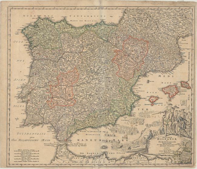
Subject: Spain & Portugal
Period: 1720 (circa)
Publication:
Color: Hand Color
Size:
22.5 x 19.3 inches
57.2 x 49 cm
This terrific, large map of the Iberian peninsula includes the Balearic Islands and part of the northern coast of Africa. This is Homann's first, and most visually impressive map of Spain and Portugal. It is filled with his typical level of detail , which includes early roads, and adorned with a marvelous pictorial cartouche. The scene shows the launching of the massive Spanish Armada. A cherub at bottom displays the royal arms for Spain and Portugal.
References:
Condition: B+
Full contemporary color on a lightly toned sheet with a bit of soiling and a number of tiny tears along the edges of the sheet that have been closed on verso with archival tape, including one that enters less than 2" into image at bottom center.