Subject: Western France
Period: 1638 (published)
Publication: Atlas Novus
Color: Hand Color
Size:
20.6 x 15.3 inches
52.3 x 38.9 cm
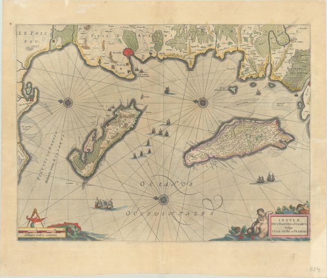
This attractive chart shows the Ile de Re and Oleron Islands off the western coast of France. La Rochelle, a fortified city on the mainland, is identified as well as a number of smaller towns. The map is adorned by three compass roses indicating north to the left, numerous sailing ships, and two cartouches at bottom featuring mer-people and sea monsters. Latin text on verso.
References: Van der Krogt (Vol. I) #4515:1.1.
Condition: B
A dark impression with full contemporary color that has been partially refreshed, light printer's ink residue, and minor toning. The map has been professionally backed in thin, archival tissue to repairs some cracks around the Ile de Re and in the title cartouche, a centerfold separation at bottom, and a chip at bottom right.