Catalog Archive
Auction 195, Lot 484

"Novissima et Accuratissima Canalis Inter Angliae et Galliae Tabula cum Omnibus suis Portibus, Arenis et Profundis", Danckerts, Theodore

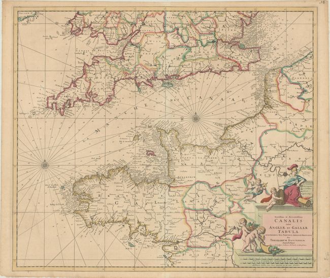
Subject: English Channel

Period: 1695 (circa)

Publication:

Color: Hand Color

Size:
23.1 x 20.1 inches
58.7 x 51.1 cm
Download High Resolution Image
(or just click on image to launch the Zoom viewer)

Magnificent chart of the channel and portions of England and France. The beautiful chart is filled with rhumb lines and two compass roses. Sandbanks, anchorages, soundings, and hazards are all meticulously noted. Three important sea battles are marked by crossed swords and dates: 1666 (Four Days Battle), 1690 (Battle of Beachy Head) and 1692 (Battle of La Hogue). Putti cavort around the cartouche, which is topped by a seated warrior maiden.

References:

Condition: B+

A crisp impression with full contemporary color on a lightly toned sheet with a professionally repaired tear at left that extends through Brittany to Saint Brieuc. There are small remnants of cello tape along the top corners of the sheet, well away from the image.

Estimate: $350 - $425

Sold for: $180

Closed on 11/15/2023

Archived