Subject: Outer Hebrides, Scotland
Period: 1654 (circa)
Publication:
Color: Hand Color
Size:
20.8 x 15.5 inches
52.8 x 39.4 cm
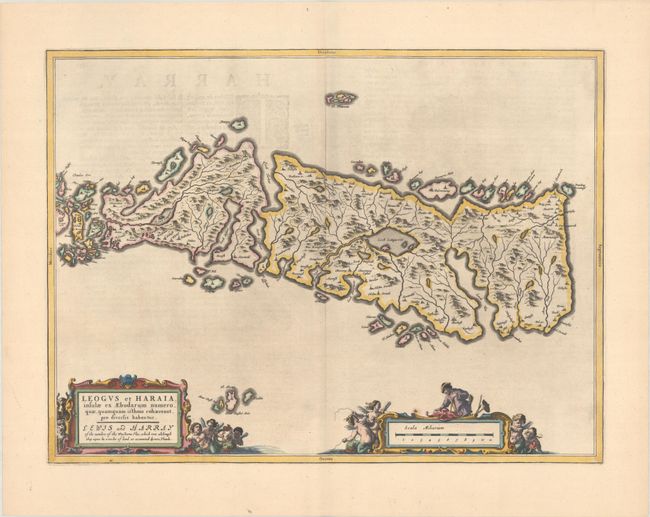
This is an uncommon and lovely map of Lewis and Harris in the Western Isles. The map is oriented with west at top and is richly embellished with decorative cartouches surrounded by sea creatures, putti, and a land surveyor. Dutch text on verso, published between 1654-62.
Publication of Bleau’s atlas of Scotland (Atlas Novus, Volume V) in 1654 was a landmark publication in cartographic history. Most of the maps were based on the surveys of Timothy Pont, which had been done half a century earlier. The publication took over seven decades to bring to publication; it was delayed by wars, copyright restrictions, and only intermittent official support. The maps are scarce today due to the relatively short publication history of the atlas.
References: Van der Krogt (Vol. II) #5862:2.
Condition: A
A dark impression with full contemporary color on a bright sheet with a large watermark of the god Atlas. There is one small rust spot just above the distance scale.