Subject: Wales
Period: 1663 (circa)
Publication: Cinquieme Volume de la Geographie Blaviane
Color: Hand Color
Size:
19.8 x 15.2 inches
50.3 x 38.6 cm
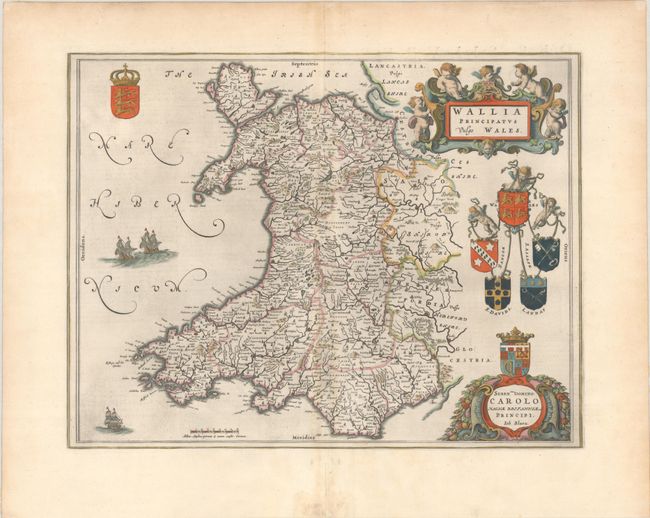
This handsome map of Wales is filled with detail and decorative elements. Towns, political boundaries, rivers, and mountains are shown, including Snowdown Hill (Snowdon), the highest mountain in the country. A strapwork cartouche with putti, several coats of arms, sailing galleons, and a dedication cartouche to King Charles I fill the blank areas of the map. French text on verso, published between 1663-67.
References: Van der Krogt (Vol. II) #5500:2.
Condition: B+
A dark impression on a bright sheet with a large watermark of the god Atlas. There is a bit of printer's ink residue, light toning and offsetting along the centerfold, and marginal soiling. There is an archivally repaired centerfold separation at bottom and small remnants of masking tape along the far edges of the sheet on verso.