Subject: England & Wales
Period: 1646 (dated)
Publication: The Theatre of the Empire of Great Britaine...
Color: Hand Color
Size:
20.3 x 15.3 inches
51.6 x 38.9 cm
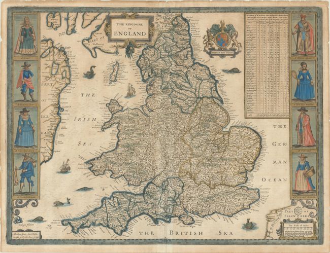
This is Speed's handsome carte-a-figures map of England and Wales, based on the work of Christopher Saxton and filled with details of towns and counties. The map is flanked by male and female pairs, including a lady and nobleman, a gentleman and gentlewoman, a citizen and his wife, and a countryman and his wife. At top right is a table indicating the number of cities, bishoprics, markets, rivers, bridges, etc. in each shire. The map is embellished with two strapwork cartouches, the Royal coat of arms, and several sea monsters and galleons. This is from the second plate engraved by Abraham Goos following Hondius' original which was wearing thin and required replacement. The imprint of Bassett and Chiswell is located at bottom right. English text on verso.
References: Shirley (BI to 1650) #318; Shirley (BL Atlases) T.SPE-1j.
Condition: B+
Issued on watermarked paper with some light toning on recto and moderate toning on verso. There are some minor edge chips and tears that have been repaired with archival materials on verso.