Subject: Western England
Period: 1675 (circa)
Publication: Britannia
Color: Hand Color
Size:
16.1 x 13.1 inches
40.9 x 33.3 cm
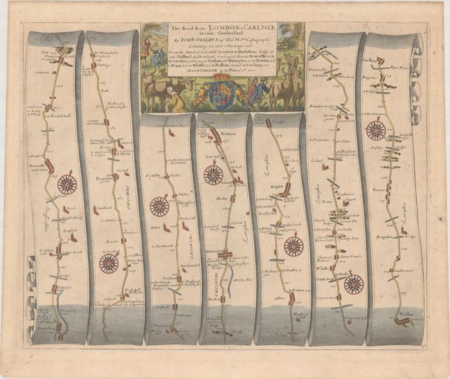
John Ogilby's 'Britannia' was published between 1675 and 1698. It is a landmark in the mapping of England and Wales. Its unique format constituted the first national road-atlas of any country in Western Europe. It was composed of maps of seventy-three major roads and cross-roads, presented in a continuous strip-form, on a uniform scale of one inch to a mile. Each beautiful map includes wonderful detail of the countryside with each strip containing a large compass rose to indicate changes in direction.
This handsome strip-stlye road map covers the road from Darlaston to Garstang. Notable towns along the way include Warrington, Wigan, and Preston. Each strip features a compass rose. The royal coat of arms and a rural farming scene with cattle surround the title cartouche.
References: Shirley (BL Atlases) T.OGIL-4a #37.
Condition: B+
A nice impression on a sheet with a horn coat of arms watermark. There are a couple of minor printer's creases, light foxing along the top of the map, and minor soiling.