Subject: Central South America, Paraguay
Period: 1639 (circa)
Publication:
Color: Hand Color
Size:
18.9 x 14.8 inches
48 x 37.6 cm
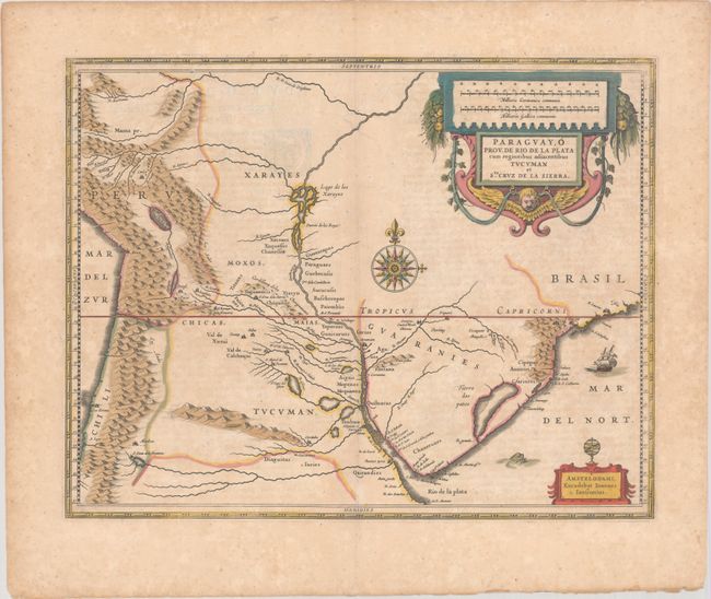
This fine map of the region includes the Paraguay River basin and the Peru-Chilean coast with Lake Titicaca. The Rio de la Plata is boldly shown with many large islands in the broad river. The mythical Lago de los Xarayes is featured on the map, which was believed to connect the Rio de la Plata and Amazon River systems. Several towns are named including Rio de Janeiro, Sao Paulo, Buenos Aires, Medoca, Arica, Potosi and Cuszco. The map is nearly identical to Blaeu's map of the same title with a large decorative title cartouche incorporating the distance scales, smaller cartouche with armillary sphere, a large compass rose, sea monster, and here Jansson has added a sailing ship off the coast of Brazil. French text on verso, published between 1639-49.
References: Van der Krogt (Vol. I) #9900:1.
Condition: B
A nice impression with full contemporary color on a lightly toned sheet with scattered foxing, minor extraneous creasing along the centerfold, and short edge tears in the blank margins. There is a short centerfold separation at top that has been closed on verso with archival tape.