Catalog Archive
Auction 195, Lot 384

"[Lot of 2] A New Map of the Island of Barbadoes, Containing All ye Parishes, and Principal Plantations... [and] The Island of St. Christophers [on sheet with] Antego Island [and] Part of ye Islands of America &c.", Moll, Herman

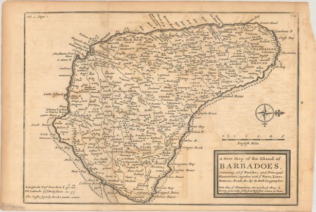
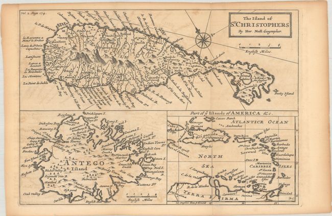
Subject: Barbados, St. Kitts & Antigua

Period: 1717 (published)

Publication: Atlas Geographus...

Color: Black & White

Size:
See Description
Download High Resolution Image
(or just click on image to launch the Zoom viewer)

A. A New Map of the Island of Barbadoes, Containing All ye Parishes, and Principal Plantations... (10.1 x 7.1"). This small map shows the island fully engraved and is filled with towns and villages, roads, mills, plantations, political divisions, and many coastal details. A compass rose orients north to the right.

B. The Island of St. Christophers... (10.2 x 7.1"). Three maps on one sheet. The upper section features a map of St. Kitts and is filled coastal place names, rivers, and mountains in the interior. At lower left is a small map of Antiqua locating St. John's, Five Island Harbor and Falmouth. At lower right is a map of the entire West Indies region.

References: Shirley (BL Atlases) T.Moll-3a #94 & #95; Campbell (MCC-21) Barbados #18; Tooley (MCC-81) St. Kitts #11.

Condition: B

Issued folding with toning and offsetting.

Estimate: $180 - $220

Sold for: $90

Closed on 11/15/2023

Archived