Subject: World, Aviation
Period: 1944 (dated)
Publication:
Color: Printed Color
Size:
33.4 x 22.3 inches
84.8 x 56.6 cm
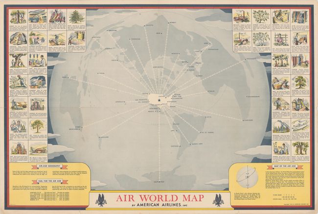
This unusual and early map from American Airlines puts the United States at the center of the world with the shortest possible flight routes radiating out to far-flung destinations all over the world. The routes are depicted as chains of airplanes, with each plane representing 250 miles or one hour of flight time. Using the map, one could calculate, for example, that a trip from Monterey to the South Pole would be a 29-hour flight across 7,250 miles! The map is surrounded by 36 vignettes of industry and natural resources. In the bottom corners are text on "Air-Age Geography," fuel, and an explanation of how to use the map.
References: Rumsey #8263.
Condition: B+
Issued folding with some short separations along the folds.