Catalog Archive
Auction 195, Lot 354

Early Map of the American Southwest and Mexico

"Hispania Nova", Wytfliet, Cornelis

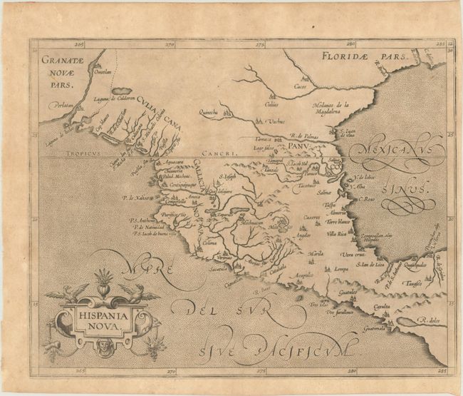
Subject: Southern United States & Mexico

Period: 1597 (published)

Publication: Descriptionis Ptolemaicae Augmentum

Color: Black & White

Size:
11.4 x 9.1 inches
29 x 23.1 cm
Download High Resolution Image
(or just click on image to launch the Zoom viewer)

This is one of the earliest maps of the American Southwest and Mexico, including the southern part of present-day Texas, here called Floridae Pars, with the Rio Grande, labeled R. de Palmas. The map concentrates on the Spanish area of influence and is one of nineteen regional maps of the Americas contained in Wytfliet's atlas, which was the first devoted exclusively to the New World. Stipple engraved seas, calligraphy, and a decorative title cartouche adorn the map.

References: Burden #105; Mickwitz & Miekkavaara #307-12.

Condition: B+

A lightly toned sheet with a coat of arms watermark and a narrow right margin.

Estimate: $950 - $1,200

Sold for: $700

Closed on 11/15/2023

Archived