Subject: Oklahoma
Period: 1902 (published)
Publication:
Color: Printed Color
Size:
6 x 9.5 inches
15.2 x 24.1 cm
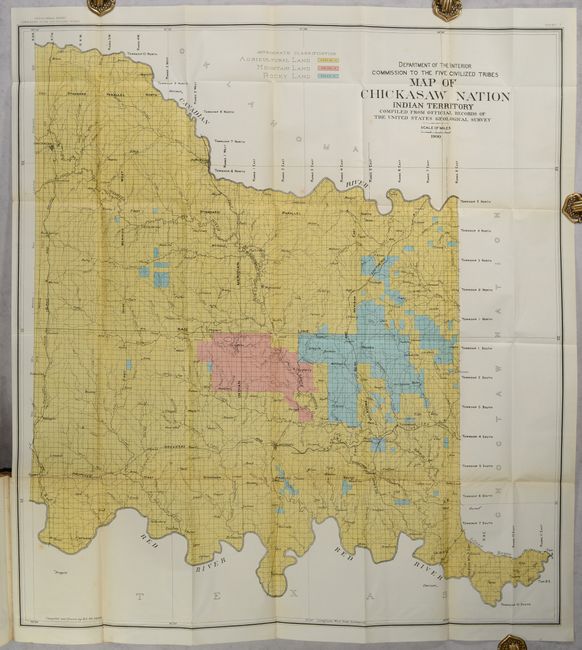
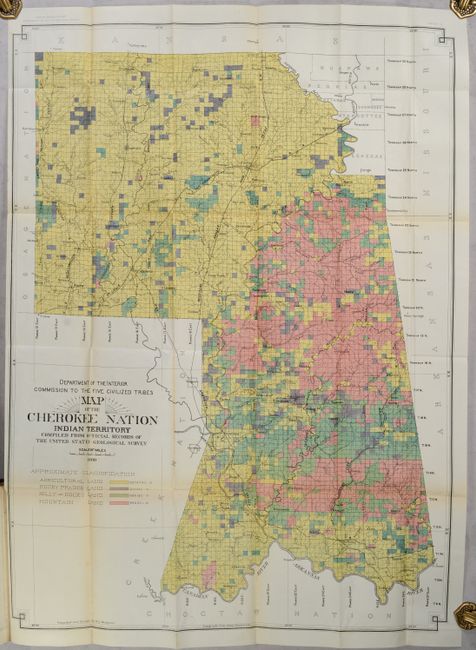
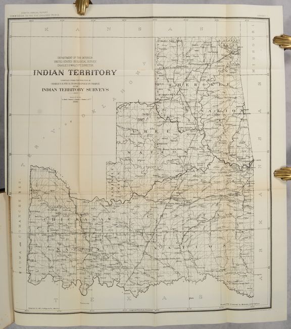
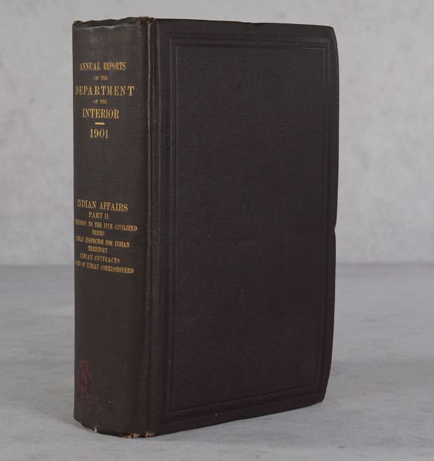
This is the eighth annual report of the Commission to the Five Civilized Tribes, with additional reports by the Indian Inspector to the Indian Territory, Board of Indian Commissioners, and an extensive listing of proposals received and contracts awarded for the Indian Service. The volume is well-illustrated with single-page plates, tables, and folding maps. Of particular interest is the map of Indian Territory (18.0 x 20.0") by Charles Fitch which matches the configuration of the rare State of Sequoyah, which the Indian Nations attempted to create in 1905 in an effort to thwart the expansive tendencies of the United States. It is also similar to the rare 1896 Senate edition which was issued in printed color. The regions of the Chickasaw, Choctaw, Creek, Seminole, Cherokee, and several other Indian tribes are named. The Territory of Oklahoma hovers ominously in the northwest. Fitch was the topographer in charge of the Indian Territory Surveys. The full listing of maps in the volume include:
A. Indian Territory, dated 1898, black & white (18.2 x 20.0").
B. Map Showing Progress of Allotment in the Creek Nation, dated 1901, printed color (24.5 x 26.5").
C. Map of Seminole Nation Showing Progress of Allotment, dated 1901, printed color (10.3 x 19.1").
D. Indian Territory - Progress of Sub-Division Survey, dated 1898, printed color (18.3 x 20.0").
E. Map of the Cherokee Nation Indian Territory..., dated 1900, printed color (25.8 x 35.0").
F. Creek & Seminole Nations Indian Territory..., dated 1899, printed color (24.6 x 26.5").
G. Map of Chickasaw Nation Indian Territory..., dated 1900, printed color (30.5 x 33.2").
H. Map of Choctaw Nation Indian Territory..., dated 1900, printed color (32.8 x 36.8").
I. Exhibit 9 Section 3..., printed color (15.0 x 15.0").
J. Exhibit 10 Section 10..., printed color (15.0 x 15.0").
K. Map of Choctaw Nation Indian Territory..., dated 1900, printed color (18.3 x 20.2").
L. Map of the Indian Territory. Showing the Progress and Status of Townsite Surveys..., dated 1901, printed color (18.4 x 20.9").
M. McGee, Chickasaw Nation, Ind. Ty., dated 1901, black & white (15.5 x 22.0").
893 pages. Hardbound in brown cloth with gilt title on spine.
References:
Condition: A
Condition code is for the folding maps, which are remarkable clean and bright with only an occasional spot of foxing and tiny binding tears. They do have light perforated blind stamps in the sheet corners that only mildly detract. Text and other plates are very good with an occasional spot of foxing and occasional blind stamps. Hinges are starting. Covers have minor wear with bumped corners.