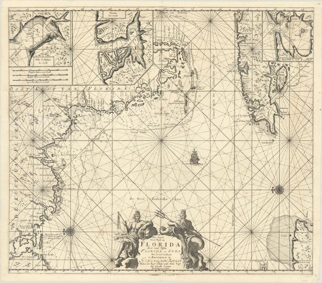
Subject: Western Florida & Cuba
Period: 1734 (circa)
Publication:
Color: Black & White
Size:
22.8 x 20.1 inches
57.9 x 51.1 cm
This uncommon chart is believed to be the first sea chart of the eastern portion of the Gulf of Mexico, and shows Florida's gulf coast from Pensacola to Cape Florida, with the western part of Cuba. The cartography is based in part on Hessel Gerritsz' chart circa 1631, and nearly all the place names on the chart are Spanish. The chart is oriented with north to the left, with a bit of the Yucatan Peninsula shown at lower right. Three insets depict the Cuban harbors: Matanzas Bay, Havana Harbor and Hondo Bay. The elaborate cartouche is flanked by Neptune, god of the sea, and one of the wind gods. This is the fifth state, with Johannes' name replaced with that of Gerard.
References: Burden #591; Martin & Martin, p. 84-85.
Condition: B+
A sharp impression on a bright sheet with several minor spots in the image and a couple of printer's creases at bottom right. There are two 1/4" holes in the image (one to to the left of the title cartouche and the other to the left of Cuba) that have been professionally repaired with a small amount of the rhumb lines replaced in facsimile. Professionally remargined at top with one tiny tear in the top border.