Subject: San Francisco, California
Period: 1943 (dated)
Publication:
Color: Printed Color
Size:
21.2 x 11.8 inches
53.8 x 30 cm
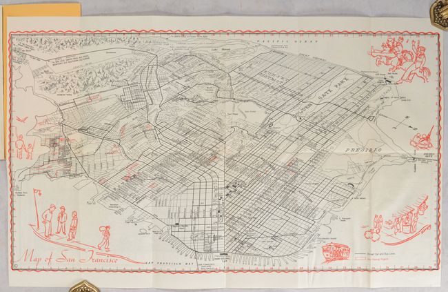
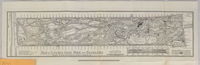
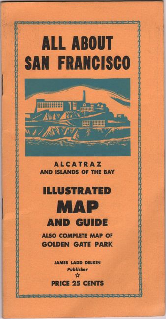
This lovely and uncommon World War II-era bird's-eye plan of San Francisco was published by James Ladd Delkin. Centered on the Mission District, Map of San Francisco extends to the Presidio and Golden Gate Bridge in the north and to Hunters Point Naval Shipyard in the south. Street car and bus lines are delineated, and war housing projects are outlined in red. The map is surrounded by vignettes, credited to Vinson, showing a man and child fishing, a crowded street car, soldiers operating a machine gun, a carousel ride, and a couple street scenes. A compass rose orients north to bottom right. On verso is Map of Golden Gate Park and Panhandle (20.3 x 5.1"), a fine pictorial plan of the area that showcases attractions such as the De Young Museum, the California Academy of Sciences, the Botanical Garden, and more. The Japanese Tea Garden is here named the Oriental Tea Garden, a reflection of anti-Japanese sentiment during the war. Dated Jan. 1943 and credited to Hugh Mooney. Delkin published another earlier map of the city and Golden Gate Park in 1939, with different illustrations. Folds into yellow stiff paper covers with an illustration of Alcatraz on the front cover. Includes 8 pages of illustrated text on the city's attractions.
References: Rumsey #8274.
Condition: A
Map is issued folding with a couple tiny splits at fold intersections and a bit of extraneous creasing. The accompanying text has small wormtracks, and covers are slightly soiled.