Subject: California
Period: 1855 (dated)
Publication:
Color: Hand Color
Size:
13 x 15.9 inches
33 x 40.4 cm
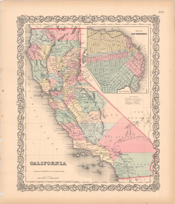
This attractive mid-nineteenth century atlas map of California shows the entire state with Utah and New Mexico territories on the eastern border. Two proposed railroad routes through the Central Valley are labeled "Explored Route for Atlantic & Pacific R.R." and a northern route through Fredonyers Pass, north of Pyramid Lake, is marked "Practicable Route for Atlantic & Pacific R.R." The only completed railroads service the Gold Regions and Sacramento. A large inset entitled "City of San Francisco" shows the planned land expansion into the bay with the streets already drawn in.
References:
Condition: A
Near fine with light toning along the sheet edges.