Subject: Colonial Mid-Atlantic United States
Period: 1676 (circa)
Publication: A Prospect of the Most Famous Parts of the World
Color: Black & White
Size:
19.6 x 14.9 inches
49.8 x 37.8 cm
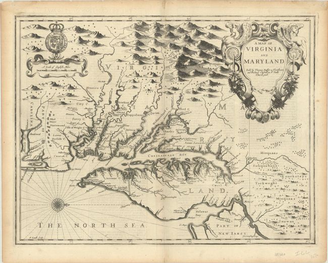
The English text verso gives an up-to-date description of the colonies, adding to the appeal of this sought-after and decorative map engraved by Francis Lamb. Oriented with north to the right, the map shows both the Chesapeake and Delaware Bays and Part of New Iarsy. Following John Smith's general outline, Lamb draws upon Augustine Herrman's landmark map for improved geography and English nomenclature, as well as its depiction of the Delaware Bay and River. The boundary between Virginia and Maryland on the eastern shore, settled in 1688, is depicted with the Herrman-like usage of a double line of trees. The map is beautifully decorated with the Royal Arms of England and a large elegant title cartouche. First state with the imprint of Bassett and Chiswell.
References: Burden #456; Goss (NA) #40; Tooley (Amer) p.170, Derivative 9, state 1; Shirley (BL Atlases) T.SPE-2f #23.
Condition: A
A sharp impression on a bright, watermarked sheet, with a bit of show-through of text on verso, a few tiny worm holes in the image, and a small hole along the centerfold just south of Chesapeake Bay that has been professionally repaired, with a minute amount of image replaced in facsimile. There is light toning along the edges of the sheet and a couple of tiny tears also along the edges.