Subject: World
Period: 1787 (circa)
Publication: Atlas Universel
Color: Hand Color
Size:
16 x 10.5 inches
40.6 x 26.7 cm
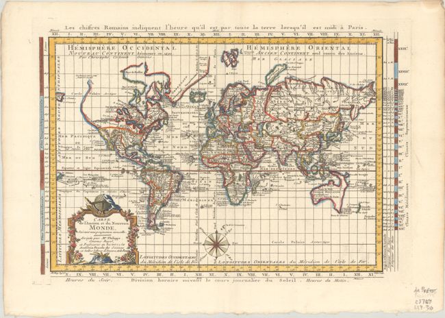
A very uncommon world map designed in a crisp style and presented on Mercator's projection. The map is very detailed, particularly in the oceans with recent discoveries noted in Greenland, Canada, and the Pacific. In North America a huge River of the West (Fl. de l'Ouest) is the most prominent feature and the northwest coast is lacking any hint of the Alaskan peninsula. Conjectural coastlines connect Australia to both Tasmania and New Guinea, and only a partial coastline of New Zealand is shown. The composition is nicely decorated with an elaborate, French-style title cartouche and a compass rose. Drawn by Maurille-Antoine Moithey and engraved by Jean Emmanuel Jerome Vallet.
References: Mickwitz & Miekkavaara #179-3.
Condition: A
Sharp impression on a bright, watermarked sheet with a deckled bottom edge and light soiling along the edges of the sheet.