Subject: Eastern United States
Period: 1929 (dated)
Publication:
Color: Printed Color
Size:
16.9 x 36 inches
42.9 x 91.4 cm
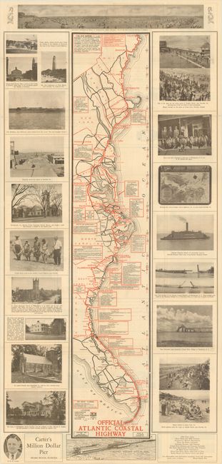
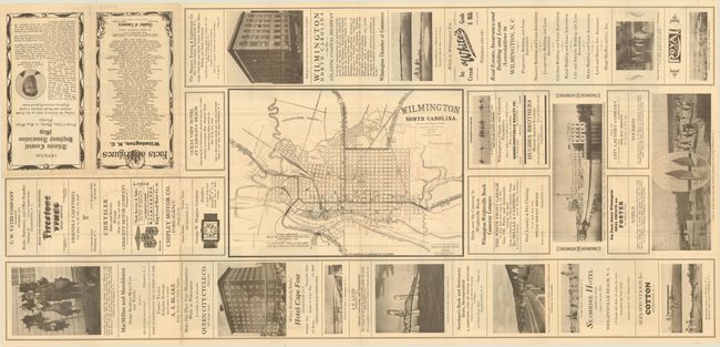
This promotional brochure was issued by the Wilmington Chamber of Commerce and contains a strip map showing the route of the Atlantic Coastal Highway from Calais, Maine to Key Largo, Florida. The map includes text describing points of interest, listing facts and figures, and is flanked by illustrations of the region. The bottom section reveals a drawing of “Carter’s Million Dollar Pier in Miami Beach,” Miami Beach’s version of the Atlantic City Steel Pier. The verso consists of a map of Wilmington surrounded by ads for Wilmington businesses. Unlike other early named roads which emphasized speedy travel, the Atlantic Coastal Highway, or Ocean Highway, promoted tourism and leisurely travel as indicated on this map. Self-folding (4.5 x 8.8").
References:
Condition: B+
Issued folding with a few fold separations that have been mostly closed on verso with archival tape.