Subject: Colonial Eastern United States
Period: 1730 (published)
Publication:
Color: Black & White
Size:
15.3 x 14 inches
38.9 x 35.6 cm
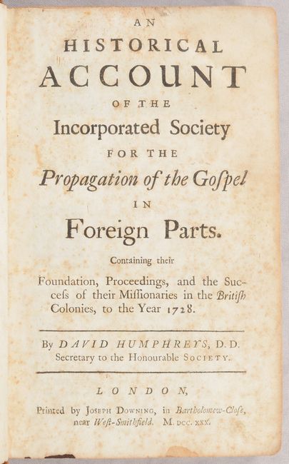
This important work was compiled by David Humphreys, the Secretary of the Society for the Propagation of the Gospel in Foreign Parts, a missionary organization founded by the Church of England to develop a strong Anglican presence in the British colonies in America. This account was compiled from letters and papers transmitted to the Society of Governors of the colonies, and details: the founding of the Society; the missionary work in the Carolinas, Pennsylvania, New Jersey, and New York; and attempts to evangelize slave and Native American populations. The book is accompanied by two scarce folding maps detailing parishes, cities, roads, and settlements of the English, French, and Native Americans:
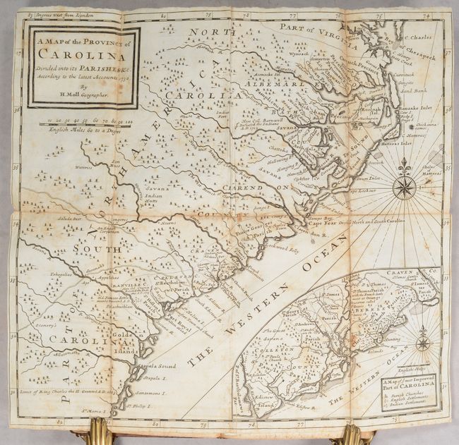
A. A Map of the Provinces of Carolina Divided Into Its Parishes &c. According to the Latest Accounts. This map extends from the Chesapeake Bay to the "Limit of King Charles the II Granted A.D. 1663," which is approximately around Cumberland Island, Georgia. The map includes an inset, A Map of ye Most Improved Part of Carolina, which details the region surrounding Charleston, South Carolina.
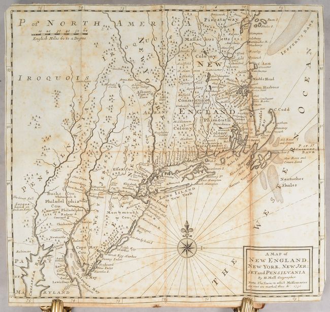
B. A Map of New England, New York, New Jersey and Pensilvania. This map focuses on New England and the Mid-Atlantic, extending from the Piscataqua River to Delaware Bay.
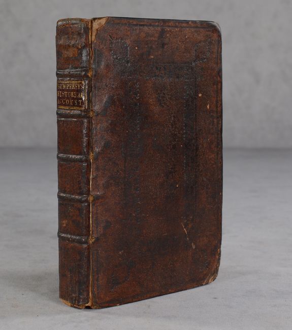
First edition. 8vo; title page, iii-xxxi pp., 356 pp., 2 maps. Hardbound in full contemporary leather with embossing on covers; raised bands and red leather title label on spine with title in gilt.
References: Cumming (SE) #209; Howes #H-795; McCorkle #730.2; Sabin #33801.
Condition: B
The maps have moderate foxing with a few short fold separations, some of which have been archivally repaired on verso. The text has light to moderate foxing. The covers have bumped corners and some abrasions, and are just beginning to detach. The spine is worn and beginning to crack.