Catalog Archive
Auction 195, Lot 152

"Map of the Canadian Pacific Railway, the Minneapolis, St. Paul and Sault Ste Marie Railway, the Duluth, South Shore and Atlantic Railway", Poole Bros.

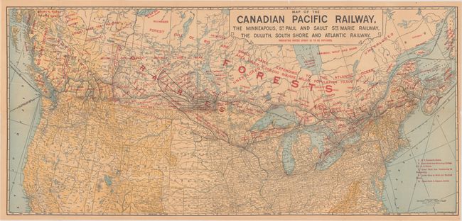
Subject: Northern United States & Canada

Period: 1904 (dated)

Publication:

Color: Printed Color

Size:
31.4 x 14.6 inches
79.8 x 37.1 cm
Download High Resolution Image
(or just click on image to launch the Zoom viewer)

This map shows the routes of the Canadian Pacific Railway from coast to coast, noting with red overprinting the types of fish and game that can be found in each region. This map was created to encourage sportsmen to take advantage of the railway in planning their next hunting or fishing trip. Areas conducive to canoe trips are also noted. The map was originally published in 1893, and this edition was corrected in 1904. It folds into original illustrated card stock covers with the alternative title Sportsman's Map of the Dominion of Canada.

References:

Condition: B+

Issued folding. The map is lightly toned with a 3" edge tear at left and a tiny edge tear at right that have been closed on verso with archival tape. There are a few short splits at the fold junctions as well. Covers have light soiling and wear.

Estimate: $140 - $170

Sold for: $45

Closed on 11/15/2023

Archived