Subject: Cape Breton & Prince Edward Island, Canada
Period: 1763 (circa)
Publication: Schauplatz des Gegenwaertigen Kriegs
Color: Hand Color
Size:
14 x 8.5 inches
35.6 x 21.6 cm
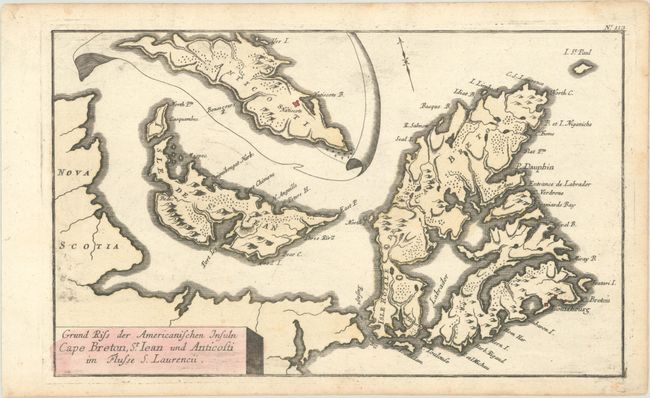
This uncommon map of Isle de St. Iean (Prince Edward Island) and Cape Breton was published in Raspe's Schauplatz des Gegenwaertigen Kriegs, which contained over 150 maps and battle plans relating to the worldwide theater of the Seven Years' War. The map includes an inset of Anticosti at top. Detail is relatively sparse, with boldly engraved topography and place names along the coast. The Fortress of Louisbourg, site of a pivotal siege in 1758, is located. Saint-Jean is of note for the Ile Saint-Jean campaign in the autumn of 1758. During this series of operations, 500 British troops, under the command of Lieutenant-Colonel Andrew Rollo, expelled the Acadians from the island. "Nr. 113" above the neatline at top right.
References: Kershaw #838; Shirley (BL Atlases) G.RASP-1a #113.
Condition: A
A dark impression with minor printer's ink residue. Light dampstaining along the sheet's edges is well away from map image.