Subject: Eastern Canada
Period: 1778 (circa)
Publication: The English Pilot. The Fourth Book
Color: Hand Color
Size:
21.8 x 17.1 inches
55.4 x 43.4 cm
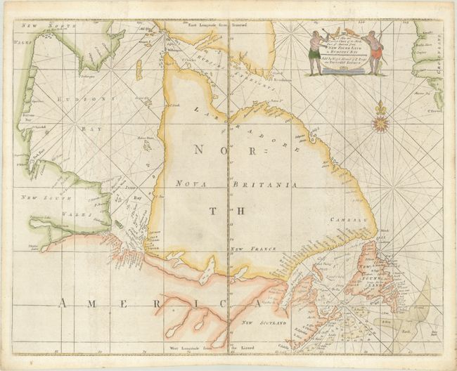
Fifth state of this important sea chart focusing on the coastal features of Hudson Bay and Labrador from the plate by John Thornton. Hudson and James bays are well-depicted for the period. Labrador, Quebec, and the Ungava Peninsula are shown as being separated from the rest of Canada by the Frenchman River, depicted reaching all the way from James Bay to Atlantic. Soundings are noted in the fishing banks. The title cartouche is flanked with Indigenous figures and animals, and rhumb lines along with a fine compass rose complement the map.
References: Kershaw #222; Sellers & Van Ee #198; cf. Verner and Stuart-Stubbs #31.
Condition: B+
There is light soiling and a small worm hole near the center of the map that has been closed on verso with archival materials. Remnants of hinge tape on verso.