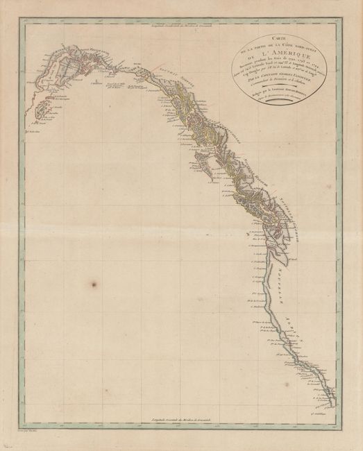
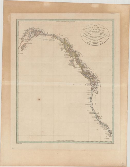
Subject: Western North America
Period: 1799 (circa)
Publication:
Color: Hand Color
Size:
13.6 x 17.2 inches
34.5 x 43.7 cm
This remarkably detailed chart covers the entire scope of Vancouver's expeditions of 1792-94. These expeditions finally closed the door on the idea of a Northwest Passage and at the same time opened the region to commerce and the fur trade. His charts of the lower Columbia River were used by Lewis and Clark on their monumental explorations. The chart includes the entire west coast from below San Diego north to Cook Inlet and Kodiak Island in Alaska. The finely engraved chart shows surprisingly good detail along the coast as it locates Port St. Francisco, Monterey Bay, C. Mendocino and C. Fairweather. Good detail up the Columbia River to Pte. Vancouver. Drawn by Lieutenant Edward Roberts and engraved by Tardieu.
References: cf. Falk #1799-3.
Condition: B+
A nice impression with minor offsetting, a couple of paper flaws in the image, and mat burn well outside of the image.