Subject: North America
Period: 1787 (circa)
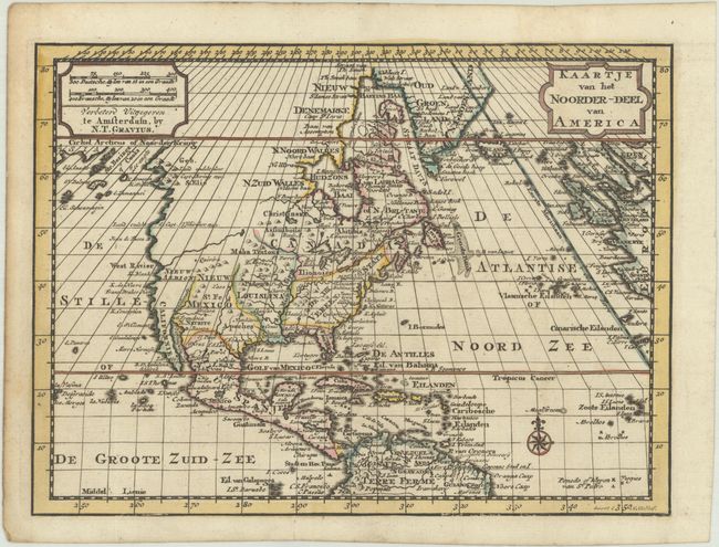
Publication: Nieuwe Natuur-Geschieden Handelkundige Zak-En Reis-Atlas
Color: Hand Color
Size:
9.4 x 7 inches
23.9 x 17.8 cm
Uncommon small map showing the new United States extending to the Mississippi River with the large territories of Louisiana and Nieuw Mexico to the west. The coastline of the Pacific Northwest is still rudimentary, with a River of the West extending to a lake in central Canada. The map is filled with minutely engraved place names, and decorated with a simple compass rose. This map was originally engraved by O. Lindeman for pocket atlases published by Jacob Keizer and Jan de Lat circa 1740-47. The plate was later sold to Nicholaes Theodorus Gravius, who had the plate updated by H. Klockhoff with new political boundaries and changes in the west. This map appeared in Gerrit Brender a Brandis' Nieuwe Natuur-Geschieden Handelkundige Zak-En Reis-Atlas.
References:
Condition: A
A dark impression with contemporary outline color, issued folding on a bright sheet with minor foxing along the edges.